Brookline’s Hidden Flood Risks: What New Maps Reveal and What They Miss
Brookline’s flood risk has long been a topic of curiosity for homeowners, investors, and local professionals. But this year, the release of FEMA’s updated flood maps sparked an important conversation: Is Brookline’s flood risk far higher than what the new maps show?
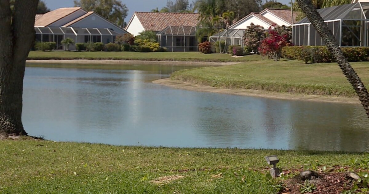
In June, FEMA introduced updated maps for Norfolk County. Brookline’s new map identifies 97 high‑risk parcels—properties with a 1% or greater annual flood chance requiring flood insurance. These parcels sit mostly around Leverett Pond and the Muddy River. Helpful as these tools are, local experts say they don’t tell the whole story.
Source: Brookline News — “Brookline’s flood risk may be higher than FEMA’s new map shows”
Read the original report
“There is a false sense of safety that many people assume if their property is not officially designated in a FEMA floodplain,” said Maria Rose, Brookline’s environmental engineer and floodplain administrator. “Flooding can happen anywhere.”
The Muddy River: Designed for Protection, Tested by Nature
Much of Brookline’s flood resilience traces back to Frederick Law Olmsted’s Emerald Necklace design—parklands surrounding waterways to buffer homes from flooding. Landscape historian Arleyn Levee emphasized that these green spaces weren’t just aesthetic; they were strategic environmental mitigation.
The town saw this system tested in the 1990s. In the floods of October 1996, more than 12 inches of rainfall overwhelmed the Muddy River system. Sediment, neglect, and obstructed waterways worsened the problem. Roads, stations, and buildings experienced significant damage.
In response, the Muddy River Restoration Project began—ultimately becoming a $92 million, decades-long effort completed largely by 2023. The improvements included dredging, invasive species removal, and daylighting buried river segments—restoring both ecological function and flood capacity.
Flooding Beyond the Riverbanks
While riverine flooding is the basis for FEMA’s models, it’s only part of the problem. Brookline experiences frequent pluvial flooding—flooding caused when stormwater overwhelms soil absorption and drainage systems.
Transportation corridors, MBTA stations, and roads bordering floodplains are vulnerable during significant rain events. Residents voiced major concerns about access, travel disruption, and emergency response times during Brookline’s Climate Action and Resiliency Plan (CARP) development.
Beacon Street: The Flooding That FEMA Doesn’t Capture
Beacon Street is one of Brookline’s most flood‑prone corridors, yet FEMA’s map labels the area low‑risk. Another model reveals a different truth.
Explore the Interactive Map: First Street Flood Factor offers a richer look at flood risks, including rainfall, tides, surges, and climate‑driven changes.
When First Street’s factors are considered, the number of Brookline properties at risk over the next 30 years jumps to over 1,300—nearly a quarter of the town.
Flood modeler Daniel Rees notes that flood maps are only “one view” of a broad, uncertain future. Being “just inside” or “just outside” a FEMA zone can mean drastically different risk levels.
Other tools, such as the USGS Coastal Change Hazards Portal, Massachusetts CZM Hurricane Surge map, and NOAA’s Sea Level Rise Viewer, provide additional lenses for evaluating risk.
Climate Change and Urbanization: A Growing Threat
Brookline officials warn that changing climate patterns are intensifying storms and reshaping flood risk. More frequent downpours combined with hard urban surfaces reduce natural water absorption, amplifying flooding potential.
“The amount of water that is now coming down in a storm is unbelievable,” Levee said, expressing doubt about whether traditional flood control designs can handle modern extremes.
Rees raised concerns familiar to many real estate and insurance professionals: Could areas like Brookline see future impacts on property values—or even insurability?
How Soon Until Brookline’s Next Big Flood?
While storms causing nuisance flooding are expected, flash floods—like those in 1996—pose serious risk even in places labeled “low‑risk.” Nationwide, over 40% of flood insurance claims come from properties outside FEMA high‑risk zones.
This reality puts communities like Brookline on alert. Climate‑fueled storms have caused catastrophic flooding in cities across the U.S. in recent years. Local officials worry that a similarly intense event could overwhelm culverts, road systems, and restored waterways.
For now, flood control measures stand ready—but their true test may be closer than residents expect.
Professionals Take Note:
Flood literacy is becoming essential for real estate agents, adjusters, insurers, and urban planners. At Cameron Academy, we train professionals nationwide to recognize environmental factors that influence property value, insurance needs, and long‑term risk.
Getting licensed or staying ahead in your career can be a journey—but it doesn’t have to be overwhelming. Grab your favorite coffee or tea, take a moment to relax, and browse through our articles. Whether you’re just starting out or renewing your expertise, we’ve got tips, insights, and advice to keep you moving forward. Here’s to your success—one sip and one step at a time!
Commercial real estate is undergoing rapid transformation driven by flexible workspaces, booming industrial demand, sustainability priorities, and advanced building technology. As tenant expectations evolve, investors and professionals who adapt to modular work environments, e-commerce driven logistics growth, green building standards, and tech integrated properties will be best positioned for long term success in an increasingly dynamic market.
Florida homeowners are getting long-awaited relief as the state ends its 1 percent insurance surcharge two years ahead of schedule. The charge, originally added after multiple insurer failures, will officially conclude on October 1, saving residents an estimated 650 million dollars. While individual savings average about 31 dollars per policy, the move signals a healthier and more stable insurance market—welcome news for homeowners, buyers, and real estate professionals across the state.
This week’s biggest real estate tech updates are reshaping how agents market listings, how builders present inventory, and how sellers prep their homes. Canva and Rechat now offer a seamless MLS‑to‑marketing workflow, PulteGroup is expanding AI to create consistent digital listings, and Simplify Home is accelerating pre‑listing improvements with pay‑at‑closing options. These innovations highlight a clear trend: real estate pros who embrace smarter tools will move faster and win more business.
A new national analysis shows that where you choose to launch your career can dramatically impact your early financial stability, job growth, and long‑term success. Wyoming, Vermont, and the Dakotas offer the strongest opportunities for entry‑level professionals thanks to abundant jobs and affordable housing. Meanwhile, states like California and Hawaii present steep challenges with extremely limited openings and sky‑high living costs. For those eyeing real estate, mortgage, insurance, or finance careers, Florida remains competitive but promising—and Cameron Academy is ready to help you get licensed and career‑ready no matter where you start.
Florida lawmakers have approved HB 399, a sweeping land‑use overhaul that aims to expand housing supply but has sparked concern over weakened local authority and potential sprawl. Supporters argue the bill will ease affordability pressures, while opponents warn it sidelines voter-approved growth protections and shifts too much power toward developers. The measure now moves to the Senate, positioning it as a pivotal issue for real estate professionals navigating Florida’s evolving regulatory landscape.
A new study shows that buyers in the Florida Keys are gaining more influence over pricing and negotiations, signaling a cooling and maturing market heading into 2026. With increased leverage on the buyer side, real estate professionals must adapt their strategies—sharpening pricing analysis, negotiation skills, and market insights—to stay competitive in a shifting Monroe County landscape.


