Brookline’s Hidden Flood Risks: What New Maps Reveal and What They Miss
Brookline’s flood risk has long been a topic of curiosity for homeowners, investors, and local professionals. But this year, the release of FEMA’s updated flood maps sparked an important conversation: Is Brookline’s flood risk far higher than what the new maps show?
In June, FEMA introduced updated maps for Norfolk County. Brookline’s new map identifies 97 high‑risk parcels—properties with a 1% or greater annual flood chance requiring flood insurance. These parcels sit mostly around Leverett Pond and the Muddy River. Helpful as these tools are, local experts say they don’t tell the whole story.
Source: Brookline News — “Brookline’s flood risk may be higher than FEMA’s new map shows”
Read the original report
“There is a false sense of safety that many people assume if their property is not officially designated in a FEMA floodplain,” said Maria Rose, Brookline’s environmental engineer and floodplain administrator. “Flooding can happen anywhere.”
The Muddy River: Designed for Protection, Tested by Nature
Much of Brookline’s flood resilience traces back to Frederick Law Olmsted’s Emerald Necklace design—parklands surrounding waterways to buffer homes from flooding. Landscape historian Arleyn Levee emphasized that these green spaces weren’t just aesthetic; they were strategic environmental mitigation.
The town saw this system tested in the 1990s. In the floods of October 1996, more than 12 inches of rainfall overwhelmed the Muddy River system. Sediment, neglect, and obstructed waterways worsened the problem. Roads, stations, and buildings experienced significant damage.
In response, the Muddy River Restoration Project began—ultimately becoming a $92 million, decades-long effort completed largely by 2023. The improvements included dredging, invasive species removal, and daylighting buried river segments—restoring both ecological function and flood capacity.
Flooding Beyond the Riverbanks
While riverine flooding is the basis for FEMA’s models, it’s only part of the problem. Brookline experiences frequent pluvial flooding—flooding caused when stormwater overwhelms soil absorption and drainage systems.
Transportation corridors, MBTA stations, and roads bordering floodplains are vulnerable during significant rain events. Residents voiced major concerns about access, travel disruption, and emergency response times during Brookline’s Climate Action and Resiliency Plan (CARP) development.
Beacon Street: The Flooding That FEMA Doesn’t Capture
Beacon Street is one of Brookline’s most flood‑prone corridors, yet FEMA’s map labels the area low‑risk. Another model reveals a different truth.
Explore the Interactive Map: First Street Flood Factor offers a richer look at flood risks, including rainfall, tides, surges, and climate‑driven changes.
When First Street’s factors are considered, the number of Brookline properties at risk over the next 30 years jumps to over 1,300—nearly a quarter of the town.
Flood modeler Daniel Rees notes that flood maps are only “one view” of a broad, uncertain future. Being “just inside” or “just outside” a FEMA zone can mean drastically different risk levels.
Other tools, such as the USGS Coastal Change Hazards Portal, Massachusetts CZM Hurricane Surge map, and NOAA’s Sea Level Rise Viewer, provide additional lenses for evaluating risk.
Climate Change and Urbanization: A Growing Threat
Brookline officials warn that changing climate patterns are intensifying storms and reshaping flood risk. More frequent downpours combined with hard urban surfaces reduce natural water absorption, amplifying flooding potential.
“The amount of water that is now coming down in a storm is unbelievable,” Levee said, expressing doubt about whether traditional flood control designs can handle modern extremes.
Rees raised concerns familiar to many real estate and insurance professionals: Could areas like Brookline see future impacts on property values—or even insurability?
How Soon Until Brookline’s Next Big Flood?
While storms causing nuisance flooding are expected, flash floods—like those in 1996—pose serious risk even in places labeled “low‑risk.” Nationwide, over 40% of flood insurance claims come from properties outside FEMA high‑risk zones.
This reality puts communities like Brookline on alert. Climate‑fueled storms have caused catastrophic flooding in cities across the U.S. in recent years. Local officials worry that a similarly intense event could overwhelm culverts, road systems, and restored waterways.
For now, flood control measures stand ready—but their true test may be closer than residents expect.
Professionals Take Note:
Flood literacy is becoming essential for real estate agents, adjusters, insurers, and urban planners. At Cameron Academy, we train professionals nationwide to recognize environmental factors that influence property value, insurance needs, and long‑term risk.
Getting licensed or staying ahead in your career can be a journey—but it doesn’t have to be overwhelming. Grab your favorite coffee or tea, take a moment to relax, and browse through our articles. Whether you’re just starting out or renewing your expertise, we’ve got tips, insights, and advice to keep you moving forward. Here’s to your success—one sip and one step at a time!
Long Island’s commercial real estate market just smashed every previous record, hitting an unprecedented $4.1 billion in 2025 deal volume—up a massive 71.5 percent from the year before. A surge in specialty-use properties like assisted living centers and self-storage facilities fueled the boom, alongside hundreds of new transactions across Nassau and Suffolk counties. With investor confidence rebounding, interest rates easing, and new buyer profiles entering the scene, the region has become one of the hottest real estate markets to watch.
Federal cuts to housing oversight in 2026 are creating a nationwide regulatory scramble, with states—especially California—rapidly stepping in to fill the gap. As the CFPB reduces its enforcement role, lawmakers and agencies across the country are crafting their own rules on mortgage compliance, consumer protection, affordability, and even AI‑driven underwriting. For real estate, mortgage, and finance professionals, the message is clear: state regulations are becoming just as influential as federal policy, making ongoing education and compliance awareness more critical than ever.
The insurance industry poured an eye‑opening $172 million into federal lobbying in 2025, making it the fourth‑largest lobbying sector in the country. Medical insurers led the spending, but property and casualty giants weren’t far behind, with APCIA, Nationwide, Liberty Mutual, and Allstate all landing among the top contributors. And this is only federal spending—state‑level influence, where regulations are truly shaped, remains vastly underreported. For professionals in insurance, real estate, and finance, these lobbying efforts play a powerful role in shaping regulations, costs, and the competitive landscape.
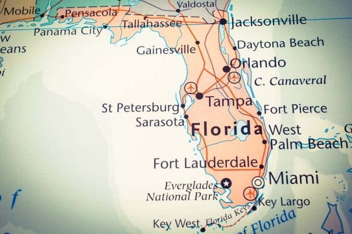
Florida’s home insurance market saw a 3.35% non-renewal rate last year—a small percentage that translated into hundreds of thousands of homeowners suddenly losing coverage. Driven by repeated storm damage, soaring construction costs, heavy litigation, and insurers pulling back from high-risk areas, the state’s insurance landscape is rapidly shifting. Homeowners now face higher premiums, fewer options, and tougher underwriting, while professionals in real estate, mortgage, and insurance must stay informed to guide clients through a tightening market.
Florida’s recent tort reforms are doing far more than reshaping the state’s legal system—they’re driving down property and casualty insurance costs by an average of 14.5% and injecting over $4.2 billion into the state’s economy each year. With nearly 30,000 jobs supported and state and local governments seeing hundreds of millions in new tax revenue, the changes are already transforming Florida’s insurance market. Lawsuits have dropped, insurers are returning, and businesses and homeowners alike are reaping the benefits of a more balanced, competitive, and financially resilient environment.
Major commercial real estate firms are reporting strong revenue and renewed market activity, signaling a rebound in dealmaking and office demand. Yet even with record earnings, CEOs from CBRE, Colliers, and Marcus & Millichap spent much of their earnings calls addressing a growing concern: whether artificial intelligence could threaten traditional brokerage and valuation roles. While leaders insist that complex transactions still rely on human relationships and negotiation, AI‑related market jitters briefly pushed some CRE stocks down before they recovered.


